

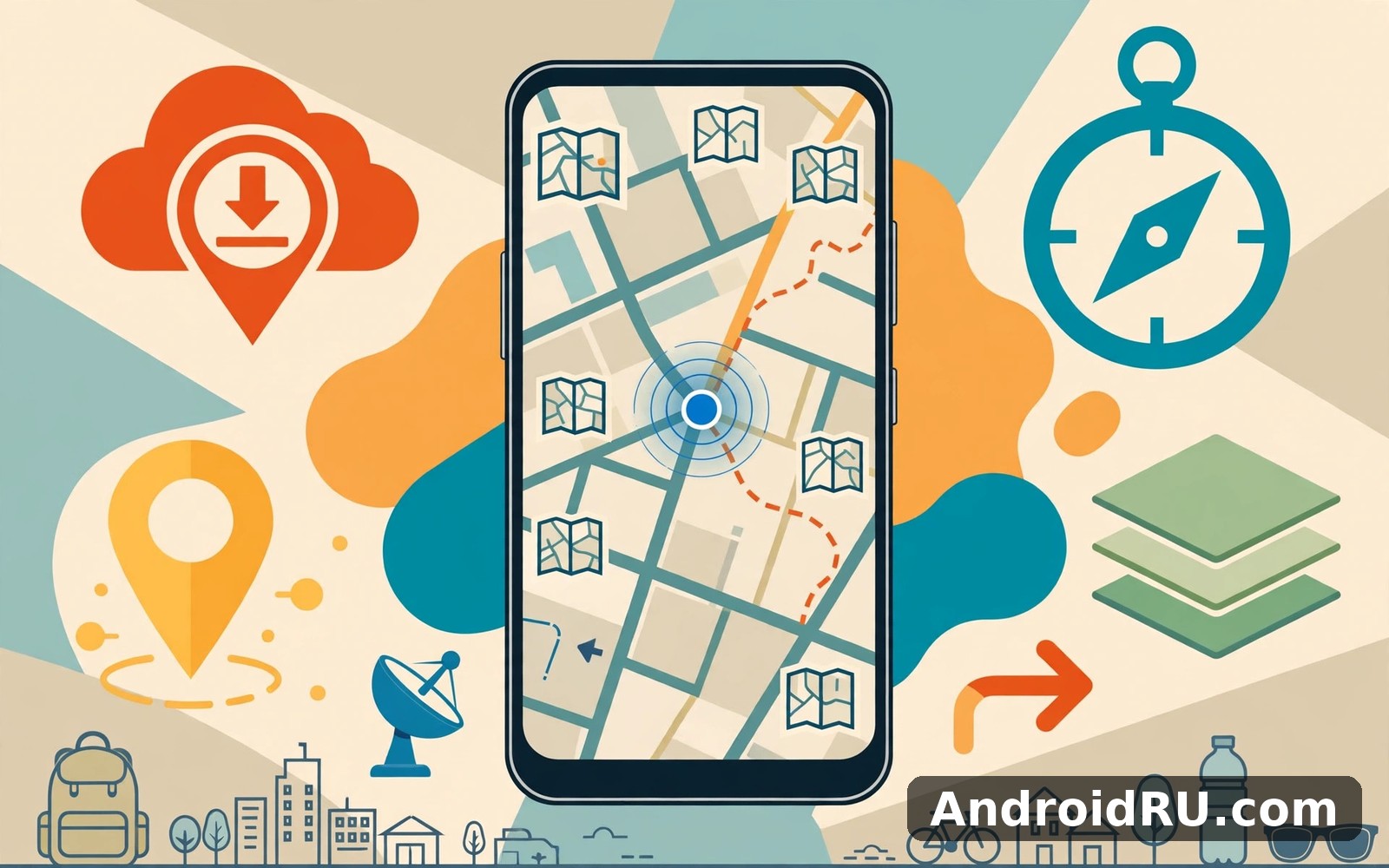
Download APK Organic Maps・offline Map GPS Feature Guide, Customization Choices & Review
I first installed Organic Maps before a weekend hike in an area where the mobile signal drops to nothing about ten minutes past the car park. I had tried paper maps, screenshots of online maps, and one big-name navigation app that kept spinning whenever the connection died. None of them felt dependable. Organic Maps felt different from the first afternoon, because the whole point of the app is that the map lives on your phone, not on a distant server. That single design choice shapes everything else about it, from how fast it opens to how little it asks of you.
This guide covers what the app actually does, how to set it up properly before you leave home, which settings are worth changing, and where it still falls short. I used it for driving, for walking around a new city, and for two long hikes with steep climbs, so the notes below come from real trips rather than from a feature list. If you travel, hike, cycle, or simply want a map that works when the network does not, the next few thousand words should help you decide whether this one earns a place on your home screen.
One thing to know up front: Organic Maps is free, open source, and built on OpenStreetMap data. There is no account to create, no advertising inside the app, and no tracking of where you go. That combination is rare among map apps, and it is the reason many people switch. The trade-off is that a few conveniences you may take for granted elsewhere, such as live traffic and business opening hours, are either missing or thinner here. I will be honest about both sides.
What Organic Maps Is and Why Offline Maps Still Matter
Organic Maps started as a community fork of Maps.me after that app changed direction. A group of the original developers and contributors rebuilt it as a fully open project, and it has been developed in the open ever since. The app runs on Android and iOS, and the maps it uses come from OpenStreetMap, the community-built world map that volunteers update every day. When a new path opens in your local park or a road closes for roadworks, someone in the OpenStreetMap community usually records the change quickly, and the next map update carries it to your phone.
Offline maps matter for reasons that have little to do with saving mobile data. The first is reliability: tunnels, valleys, rural roads, basements, and crowded stadiums all kill signals at the worst moment. An offline map keeps working through all of them because the data is already on the device. The second is speed. Searching for a street or recalculating a route takes a fraction of a second when nothing has to travel over a network. The third is privacy. A map that never phones home cannot build a record of where you live, where you work, or where you spend your weekends.
That said, offline maps come with one real cost, and you should know it before you install anything: storage. A map of a small country or a single region is usually tens of megabytes, while a large country can run into several hundred megabytes. That is the price of carrying the whole map with you, and it is worth paying only if you actually use the app. My advice is to download the regions you travel in, keep them updated, and delete the ones you no longer need. The app makes all three of those jobs easy, which is more than I can say for some of its rivals.
Who built Organic Maps and what it costs
Organic Maps is developed by a non-profit community and the app itself costs nothing. There are no paid tiers, no subscriptions, and no in-app purchases. Development is funded by donations, which means the app never has to sell your attention or your location to stay alive. That funding model is also the reason new features arrive at a steadier, slower pace than in a big commercial app. You get careful, well-tested releases rather than a new gimmick every month, and for a tool you trust with navigation, I count that as a strength rather than a weakness.
How Organic Maps differs from a normal map app
A normal map app treats your phone as a window onto a server. It fetches map tiles as you scroll, asks the server for routes, and sends your search terms away to be answered. Organic Maps flips that around: the phone holds the map, the routing engine, and the search index. The result is an app that opens fast, works in aeroplane mode, and stays quiet about your movements. The visible difference is small on a good connection, and it becomes enormous the moment the connection disappears. If you have ever watched a navigation app freeze at a motorway junction because the signal dropped, you already understand the appeal.
Organic Maps Offline Map GPS Features That Define the App
The feature set is narrower than a big commercial map, and that is deliberate. Every feature in Organic Maps works offline, which means the developers only ship things that can run entirely on the phone. What you get is a focused toolkit: maps, search, routing, bookmarks, and tracks, all tuned for people who move around in the real world. I will walk through the pieces that matter most, in the order you will actually use them.
Offline maps built on OpenStreetMap data
The maps are vector maps, which means they are drawn from data rather than downloaded as pictures. That matters for two practical reasons. First, vector maps take up far less space than image tiles, so a whole country fits comfortably on a modern phone. Second, they stay sharp at every zoom level, from a view of a whole region down to a single footpath. You can zoom into a hiking trail and still read the path clearly, which is exactly where picture-based maps turn into a blur. The data includes roads, footpaths, cycle paths, buildings, parks, water, and points of interest such as cafes, pharmacies, viewpoints, and mountain huts. Coverage is strongest in Europe and in cities worldwide, and it keeps improving as more volunteers contribute.
One detail I appreciate: the app shows offline vector maps with contour lines and elevation shading on hiking terrain, so a steep climb is visible before your legs discover it. That is the kind of practical touch that tells you the developers actually walk the trails they map.
Turn-by-turn navigation without mobile data
Organic Maps gives spoken turn-by-turn directions for driving, cycling, and walking, all computed on the phone. You type a destination, pick a mode of transport, and the app builds the route in a second or two. Voice guidance reads out the turns, and the screen shows distance to the next turn, the road name, and an estimated arrival time. I tested driving directions on a two-hour motorway trip and walking directions through a city centre, and both worked without a single bar of signal. The routing is sensible rather than clever: it prefers main roads for cars, quieter streets for cycling, and pavements and footpaths for walking. It will not reroute you around a traffic jam, because it cannot see live traffic, and that is the honest limit of the whole approach. For a planned trip on open roads, I have never missed live traffic. For a rush-hour commute through a congested city, I still check a live-traffic app before I leave.
Bookmarks, tracks, and saved places
Bookmarks are the app’s way of saving places, and they are more useful than they first look. You can drop a pin anywhere, give it a name and a colour, group it into a list such as “Hiking huts” or “Cafes to try”, and share the list with a friend. I keep a list for every trip: the hotel, the trailhead car park, the viewpoint, and the restaurant we liked. Because the lists are stored as standard KML files, you can export them, back them up, or open them in another mapping tool. Tracks work the same way. Start recording before a hike and the app draws your path, logs distance and elevation gain, and lets you save the route as a GPX or KML file to share or to follow again next year. Importing a GPX file from a friend or a walking website is just as easy, and the route appears on the map ready to follow.
Search that works offline
Search is the feature most people worry about with an offline app, and it is better than I expected. You can search for an address, a place name, a category such as “pharmacy” or “campsite”, or a set of coordinates, and the app answers from the data already on your phone. Results appear fast, and each one shows its distance and direction from you. The weak spot is business information: opening hours, phone numbers, and reviews are often missing or out of date, because that kind of detail changes constantly and OpenStreetMap volunteers cannot keep up with every shop on every street. For finding a place, the search is excellent. For checking whether the place is open right now, you will still want the web.
How to Download Maps and Navigate Without a Connection
Setting up Organic Maps takes about ten minutes, and most of that time is the download itself. Do it at home on Wi-Fi, the night before a trip, and you will never think about it again until the app asks you to update a map. The steps below are the routine I follow before every trip, and they have kept me out of trouble on roads and trails where a mistake would have cost an hour.
Downloading a region map step by step
Open the app, tap the menu, and choose the map download screen. You will see a list of countries and regions, each with its file size shown next to it. Pick the region you need, tap download, and wait for the progress bar to finish. Smaller regions finish in under a minute on decent Wi-Fi; a large country can take several minutes. Once the download is done, the map is yours. You can search it, route across it, and zoom into it with the phone in aeroplane mode. Repeat the process for every region on your route, including the region you will drive through rather than only the one you are heading to. I learned that lesson on a cross-border drive when the map ended exactly at the border and the next country was a blank grid.
Checking map size before you download
Before you tap download, look at the file size and at the free space on your phone. A region map is usually between 10 and 100 megabytes, and a large country can pass 500 megabytes. If your phone is nearly full, download only the regions you need for the next trip and remove old ones first. The app shows the size of every map you already hold, so a quick tidy takes a minute. I keep three or four regions on my phone at any time and delete the rest, which keeps the app light and the updates quick.
Updating maps when new versions arrive
OpenStreetMap changes every day, and Organic Maps publishes updated map files regularly. The app will tell you when a newer version of one of your maps is ready, usually with a small badge on the download screen. Updating is a single tap per map, and the new file replaces the old one. I update my maps once a month and always the day before a trip. A map that is a year old can still route you well, but a new housing estate, a diverted footpath, or a renamed street will only appear in the fresh file. Fresh maps are free, so there is no reason to travel on stale data.
Planning a route before you leave home
The best time to plan a route is at the kitchen table, not at the side of the road. Search for your destination, tap it, choose your mode of transport, and study the route the app draws. Check the total distance, the estimated time, and the elevation profile if you are walking or cycling. If the route takes you down a road you do not like, drag the route or add a waypoint through a place you prefer, and the app recalculates around it. Save the route as a bookmark or a track so you can pull it up with one tap when you set off. I also save the destination as a bookmark with a clear name, because typing an address with cold hands at a trailhead is a miserable experience.
One more habit worth building: download the map and plan the route while you still have Wi-Fi, then switch the phone to aeroplane mode for a minute and test the whole thing. Search for the destination, start navigation, and confirm the voice guidance speaks. If it works in aeroplane mode at home, it will work on the mountain. That sixty-second test has saved me from discovering a missing map at the worst possible moment.
Organic Maps Customization Choices: Map Styles, Voice, and Display
Organic Maps does not bury you in settings, and that is a deliberate choice. The options it does offer are the ones that change how the map feels in daily use, and a few minutes spent on them makes the app noticeably better. Here are the choices that matter, and the values I settled on after a month of adjusting them.
Map styles and layers you can switch
The app ships with a standard map style, a dark style for night driving, and an outdoor style that emphasises footpaths, contour lines, and natural features. The outdoor style is the one I use for hiking, because it makes trails and elevation easy to read at a glance. The dark style is the right pick for night driving, since a bright map in a dark car is tiring and distracting. You can switch styles from the settings menu in a few seconds, and the app remembers your choice. There is also an option to show or hide certain layers, such as public transport lines, so you can keep the screen as clean or as detailed as you like. I keep the map fairly plain for driving and turn on the detail for walking, because a driver needs the road and a walker needs everything around it.
If you enjoy exploring new places on foot, you may also like a weather companion for planning the day. Weather Radar Meteored News is a handy check before a long walk, since rain changes a hiking plan faster than any map setting. For drivers, Car Play Sync for Android Auto is a natural companion when you want the phone and the car screen to work together, and AutoZen Car Dashboard Launcher gives the car screen a simpler layout for the road. I use the map itself for navigation and these companions for the jobs around it.
Voice guidance and units
Voice guidance can be turned on or off, and you can pick the voice language from the list the app offers. I keep voice on for driving and off for walking, because a spoken instruction every few minutes is helpful on a motorway and annoying on a quiet trail. The app also lets you choose between kilometres and miles, and between metric and imperial units for altitude. Set these once to match the country you are in and forget about them. There is a setting for the map’s language too: you can show place names in the local language, in English, or in both, which is a small thing that makes a big difference when you are reading road signs in a country whose alphabet you do not know.
Display choices that reduce eye strain
Text size, map rotation, and the position of the zoom controls all sit in the settings, and each one is worth a look on your first day. I set the map to rotate with my direction of travel when driving, so the road ahead is always at the top of the screen, and I set it to stay north-up when walking, so I can relate the map to the landscape around me. The zoom buttons can be moved to the side your thumb reaches most easily, and the app supports the standard pinch gesture as well. None of these settings is complicated, and together they decide whether the app feels like it was made for your hands or for someone else’s.
Hiking, Cycling, and Driving With Organic Maps
Most map apps are built for drivers first and everyone else second. Organic Maps is unusual because walking and cycling get the same care as driving, and on some days they get more. The sections below cover how each mode behaves in real use, including the small details that only show up after a few hours on the move.
Hiking trails and contour lines
This is where Organic Maps earns its keep. Footpaths, bridleways, and hiking trails are drawn clearly, contour lines show the shape of the ground, and peaks, springs, shelters, and viewpoints are marked. The elevation profile for a planned route shows every climb before you start, so you can judge whether a “moderate” walk is moderate for you or only moderate for the person who wrote the guidebook. I followed a ten-kilometre ridge walk using only this app and a downloaded map, and the path on the screen matched the path under my boots at every junction, including two turns I would have missed without it. The recording feature logged the whole walk, and the saved track now sits in my list of routes to repeat in autumn.
One honest limit: the app does not warn you about path closures or dangerous conditions, because that information lives outside the map data. Check local walking advice and the weather before a serious hike, and treat the map as a guide rather than a guarantee. A path that exists on the map can still be closed, flooded, or overgrown, and no app can know that from data alone.
Cycling routes and elevation profiles
Cycling directions favour cycle paths and quiet streets over busy main roads, and the elevation profile is just as useful on a bike as on foot. A climb that looks gentle on a flat map can be a wall in real life, and the profile shows it plainly. I used the app for a weekend of leisure cycling along a river path, and the routing kept me off the main road for almost the whole ride. The one gap is surface information: the app knows a path exists, but it does not always know whether that path is smooth tarmac or rough gravel. If you ride a road bike, check the surface on a cycling-specific source before committing to a long off-road section. For a hybrid or mountain bike, the question matters less, and the routing works well as it stands.
Driving with an offline navigator
Driving directions are calm and predictable. The app picks sensible main roads, gives clear instructions in good time, and recalculates quickly if you take a wrong turn. Speed limits are shown where the map data includes them, and the app can warn you when you pass the limit, which is a small feature I have come to rely on in unfamiliar towns. What you will not get is live traffic, roadwork alerts, or police warnings, and on a congested commuter route that absence is real. My rule is simple: Organic Maps for planned trips, holidays, and rural driving, where the roads are open and the scenery is the point; a live-traffic app for the daily commute through a busy city. Used that way, the offline navigator is a pleasure rather than a compromise.
Organic Maps vs Google Maps and Maps.me: A Side-by-Side Comparison
People usually ask how Organic Maps stacks up against the map they already have, so here is a direct comparison with the two apps it is most often measured against. Google Maps is the live, connected giant. Maps.me is the older offline app that Organic Maps grew out of. The table below compares them on the criteria that decide a daily choice, and the notes after it explain the trade-offs in plain terms.
| Feature | Organic Maps | Google Maps | Maps.me |
|---|---|---|---|
| Works fully offline | Yes, maps, search, and routing | Partial, limited offline areas | Yes, maps, search, and routing |
| Live traffic and road alerts | No | Yes | No |
| Advertising and tracking | None, no account needed | Ads and location history | Ads in the free version |
| Map data source | OpenStreetMap | Google data | OpenStreetMap |
| Hiking and cycling detail | Excellent, trails and contours | Basic | Good |
| Business hours and reviews | Thin or missing | Extensive | Thin |
| Cost | Free, open source | Free with ads and data use | Free with ads |
| GPX and KML import and export | Yes, both directions | Limited | Yes |
The table tells a clear story. If live traffic and business information decide your choice, Google Maps wins and there is no point pretending otherwise. If privacy, offline reliability, and trail detail decide it, Organic Maps wins by a wide margin. Maps.me sits between the two on paper, but its development has slowed and its free version carries advertising, which is why so many of its former users moved to Organic Maps. The honest answer for most people is to keep two map apps: Organic Maps for travel, hiking, and anywhere the signal is thin, and a live map for the city commute. They complement each other rather than competing for the same job.
One more comparison worth making is the cost in attention. Google Maps asks for an account, a location history setting, and regular decisions about what to share. Organic Maps asks for nothing. You install it, download a map, and use it. That difference is easy to undervalue until you have used a quiet app for a month and then return to one that wants something from you every time you open it. I keep coming back to the quiet one.
Pros and Cons of Organic Maps After Real Use
After several weeks of daily use across driving, walking, and hiking, the balance of strengths and weaknesses is clear. I list them plainly here, because a review that only praises is not a review at all. The strengths are structural, built into how the app is designed. The weaknesses are real too, and they matter more to some people than to others.
What works well
- Privacy-first navigation with no account, no advertising, and no location tracking, so the app never builds a record of where you go.
- Full offline maps, search, and routing, which keep working in tunnels, valleys, and rural areas where other apps freeze.
- Excellent detail for hiking and cycling, including footpaths, contour lines, elevation profiles, and marked viewpoints.
- Fast, clean interface that opens quickly and stays readable in bright sunlight and in the dark.
- Free and open source, with bookmark and track files in standard formats you can export, back up, and share.
- Regular map updates from OpenStreetMap, so new paths and road changes reach your phone without a subscription.
Where it falls short
- No live traffic, roadwork alerts, or incident reports, so congested commuter routes are better served by a live-traffic app.
- Business information is thin: opening hours, phone numbers, and reviews are often missing or out of date.
- Search can miss newer businesses and places whose details have not yet reached OpenStreetMap.
- Public transport directions are limited compared with a city transit app, and timetables are not live.
- Map coverage and detail vary by region, and some rural areas outside Europe are less complete than a commercial map.
Look at that list and ask which side matters more for your own travel. If your days are mostly city driving with traffic, the cons list will weigh heavily. If your days involve travel, walking, cycling, and places where the signal is unreliable, the pros list wins easily. For me, the deciding factor was simple: the app works in exactly the situations where every other map app I owned stopped working, and that is worth more than a traffic alert.
Frequently Asked Questions About Organic Maps
Is Organic Maps really free, and does it work without the internet?
Yes to both. The app costs nothing, has no subscription and no in-app purchases, and the maps, search, and routing all run on the phone. You need the internet only to download a map the first time and to update it later. Once a region is on your phone, you can use it with mobile data off and the phone in aeroplane mode. GPS itself does not need the internet, so your position on the map stays accurate offline.
How much storage do Organic Maps offline maps need?
It depends on the region. A small region is often 10 to 50 megabytes, a medium-sized country is usually 100 to 300 megabytes, and a very large country can pass 500 megabytes. The app shows the size of each map before you download it, so you can choose only the regions you need. If space is tight, download one region at a time, use it, and delete it when the trip is over. I keep three or four regions on my phone and remove the rest.
Can Organic Maps replace Google Maps completely?
For many people, yes, and for some, no. It can replace a live map for travel, hiking, cycling, and driving on open roads, where offline reliability and trail detail matter most. It cannot fully replace one for a congested daily commute, because it has no live traffic, and it cannot replace one for finding business hours and reviews. The practical answer is to keep both and use each for the job it does best. That is what I do, and the offline app gets opened far more often than I expected.
Does Organic Maps show hiking trails and elevation?
Yes, and this is one of its strongest areas. Footpaths and hiking trails are drawn clearly, contour lines show the shape of the ground, and a planned route comes with an elevation profile that shows every climb. You can also record your own walk as a track and import GPX or KML routes from walking websites and friends. Trail coverage is best where OpenStreetMap volunteers are active, which includes most of Europe and many popular hiking areas worldwide.
Final Verdict and Who Organic Maps Is For
Organic Maps is the map app I reach for when the trip matters and the signal cannot be trusted. It is fast, quiet, private, and honest about what it does. It will not show you live traffic, and it will not tell you whether the cafe around the corner is open right now. What it will do is put a complete, detailed map in your pocket, guide you along a trail or a country road without a single bar of signal, and never ask for an account or sell your movements. For a navigation tool, that is a remarkably good deal.
Who should install it
Install it if you hike, cycle, travel abroad, drive rural roads, or live somewhere the signal is patchy. Install it if you care about privacy and want a map that works without an account. Install it as a second map app even if you keep a live map for the commute, because the day your main map freezes at a junction is the day you will be glad the offline one is already on your phone. Skip it only if your whole life is city driving with traffic and you never leave a good signal, and even then, keep it in mind for the next holiday. The download is free, the setup takes ten minutes, and the first offline trip is the moment the app proves itself.
Your next step is simple: install the app, download the map of your home region tonight, and take a walk with it tomorrow. Plan a short route, save the destination as a bookmark, and try the navigation with mobile data switched off. If it guides you home without a hiccup, you have a map you can trust on the mountain as well as on the street.
When you are ready to give Organic Maps a proper try, use the link below. Click here to download the Organic Maps・offline Map GPS app
If you want a weather check before a long walk, Click here to download the Weather Radar Meteored News app. For the drive itself, Click here to download the Car Play Sync for Android Auto app.